 |
![]()

| C5 Landscape Database API 2.0 An Open Source GIS API for Digital Elevation Model processing and performance © C5 corporation 2002-2006, under the GNU Lesser Public License (pre-2.0 libraries) and C5/UCSD AESTHETIC USE LICENCE (2.0 libraries: see source code for details).
|
|||
|
*New Release* New Features in version 2.0:
Version 2.0 of the API has been supported by UCSD, CALIT2, The Center for Research in Computing and
the Arts, and the San Diego Super Computing Center. It includes contributions from Angela Chen, Caroline
McLaughlin, and Brandon Stow. |
|||
|
Previous release
Version 1.0.3 features:
Version 1.0.3 was exhibited in Fair Assembly: Making Things Public, Online project at the Zentrum für
Kunst und Medientechnologie (The Center for Art and Media Technology), Karlsruhe, Germany,
March 18th 2K5, Curator: Steve Deitz.
View the javadoc documentation HERE. (Scroll Down for Download) |
|||
|
Overview of C5 Landscape Database API 2.0
The C5 Landscape Database API 2.0 began as a
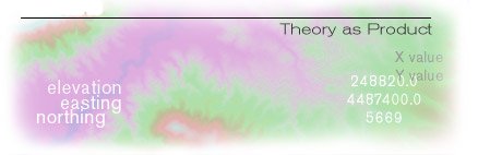
Digital Elevation Model browser and data export tool, (DEM Tool), written in java.
Now a part of the C5 Landscape Database API packages, the C5 DEM Tool is still useful
for browsing a collection DEM files via a simple graphical user interface. But since
the original release of the Dem Tool utility and related classes in 2002, the library
of related Java packages have grown and were significantly reorganized. The mission of
the API also drifted as C5 theorized the relationships between landscape data and art
practice and began implementing software mediated performances in the landscape, all
of which led us to theorize more, rewrite the software, and perform yet more experiments
in the landscape. Now merged with the capabilities of a number of C5 Perl modules (which
were retired after being ported to java in 2005), the software has evolved into a
robust platform for data mediated practice in the landscape, through much experimentation
and performance during the course of developing the C5 Landscape Initiative Projects.
For example, The Other Path (2004 and ongoing). See also
Deitz, Steve, The Path More or Less Taken,
May 2005 Written in Java, C5 Landscape Database runs on UNIX variants and Windows systems with Java 1.5
(Java 2), or any other system for which Java 2 is implemented. Background C5 research into GIS and GPS (the Global Positioning System) combines our interest in self-organization, social networks, and surveillance with our expertise in knowledge engineering, data visualization, autopoietic theory, mingling theory, database, and tactical/collaborative/situational systems and analysis. C5 seeks to redefine the application of GIS by creating leading edge software tools with practical applications in conceptual art and tertiary exploration (coming after initial exploration, and after being modeled as data) of the face of the Earth. C5 has a keen interest in the areas of outdoor recreation and land use such as hunting, fishing, performance art, OHV use, land art, and team/collaborative activities including a wide range of sporting events such as cycling and endurance racing. C5 has been deploying projects, performances and software enabling interaction with DEM data and GPS technology for training and performance art, which have feed back onto the software, interaction with DEM data, and applications GPS technology for training and performance art. The C5 Landscape Database API is an auxiliary effort in support of this project. View the javadoc documentation HERE.
C5 Landscape Database API 1.0.3 has only been tested for use with Digital Elevation model files released by the USGS after Oct 14, 2001.
C5 Landscape Database API 2.0 has not been tested on any DEM files with planimetric systems other than UTM, or on any file using arc seconds as a unit of measurement.
All test DEM files were converted from SDTS by sdts2dem.
|